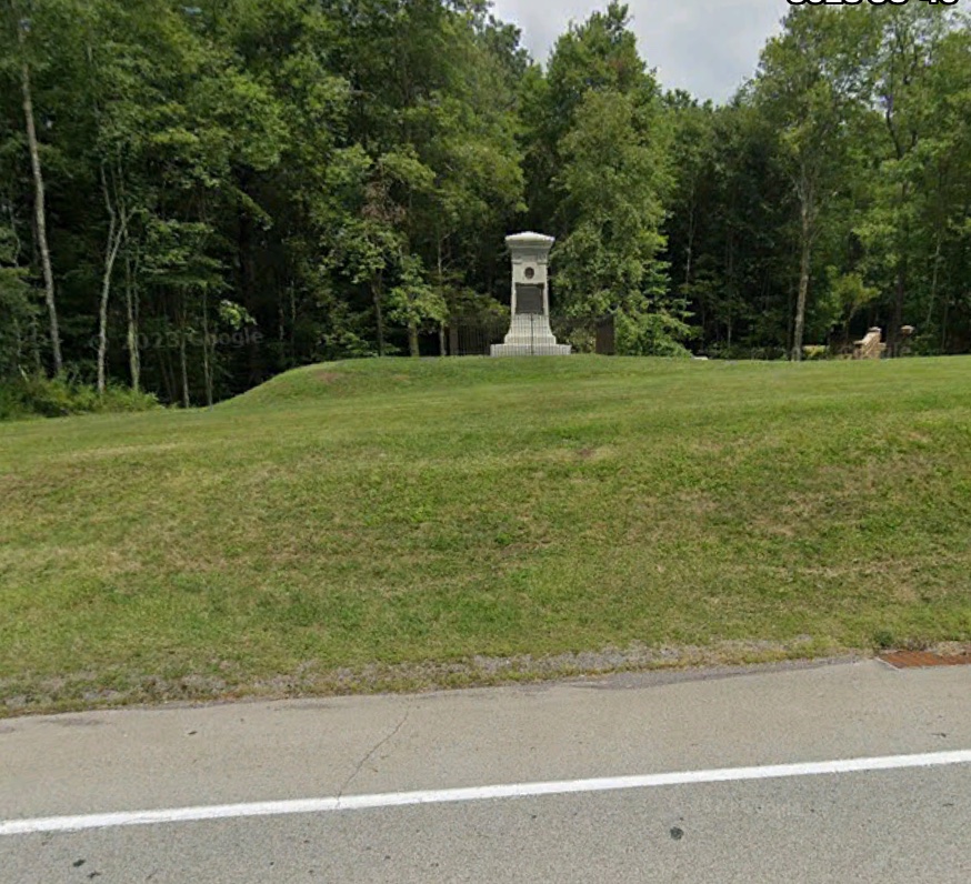
Alongside the National Highway, also known as Highway 40, in Fayette County Pennsylvania stands a monument marking the grave of General Edward Braddock. Braddock was a British General killed fighting the French and their Indian allies July 9th 1755 at the battle of the Monongahela.
Braddock died trying to wrest control of what is now the Pittsburgh area from the French in the first major battle of what is now known as the Seven Years War or French and Indian War (1754-1763).[1] This was not the first war between the French and their Indian allies, and the British in North America. There were several other wars between these foes starting in the late 1600’s. In actuality the colonial era was a period of almost perennial warfare as the Europeans struggled between themselves and the native population for control of the newly discovered continent.
An opening shot in the Seven Years War was a skirmish between the French and an expedition led by George Washington that took place at nearby Jumonville Glen. The glen was a location named for a French officer that lost his life to the hatchet of a vengeful Indian Chief when the French and British units met there May 28th, 1754.[2] It was at this time that Washington recognized the strategic value of the meadow at the location of what would later become Fort Necessity.
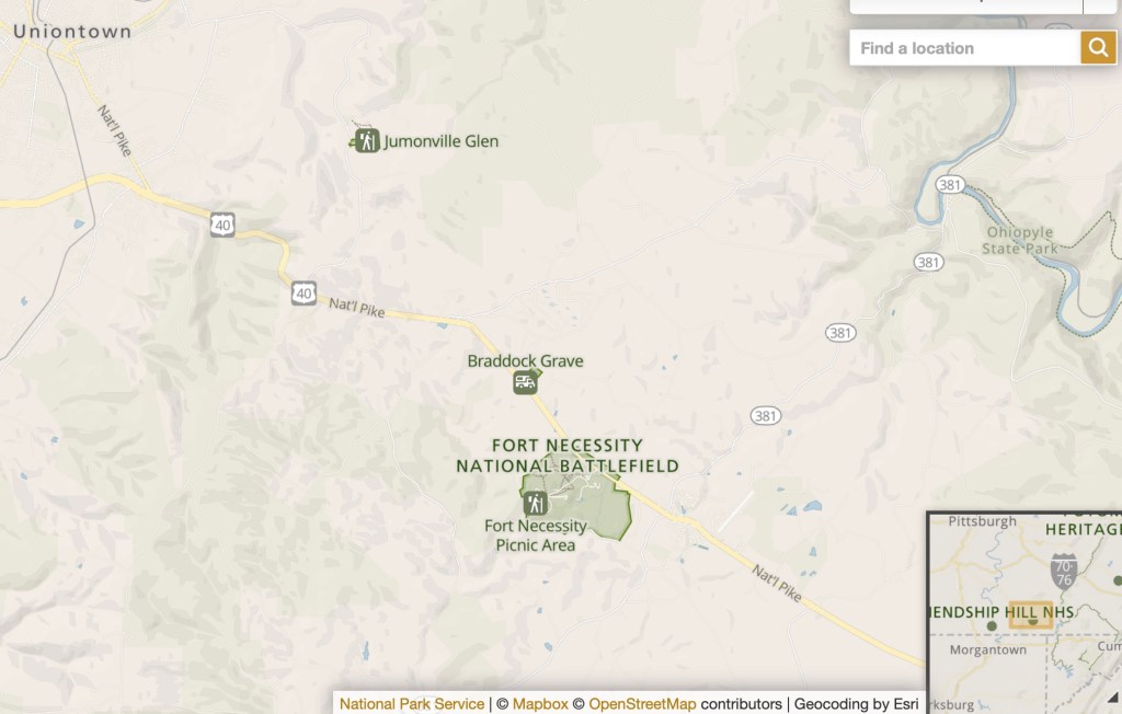
The National Park Service has an excellent visitor center and museum at the site of Fort Necessity. The rebuilt fort, actually a small circular stockade, is a short walk from the visitor center. With the informative displays at the museum, and descriptive placards along the path to the fort, the visitor can visualize the predicament of the British in the day long battle of Fort Necessity and in their retreat from having lost the Battle of the Monongahela. [3]

Fort Necessity National Battlefield is an early appearance in the historical record of George Washington. He personally blends life as a British colonial and as a United States national into one continuum, evidence that the historical experience of the nation is a single fabric not two separate histories. There are other battlefields on the nation’s continuum from colony to nationhood dating from the earliest days of North American colonization that are now obscure but that deserve equal attention as National Battlefields.
Not long after the American Revolution the National Highway became a major transit route for settlers moving west.[4] The people that now live along that highway show that they remember the part the highway played in the nation’s history. The route is thickly peppered with red, white and blue bunting and American flags. As the country opened to settlement westward the road saw 200,000 people transit it a year.
One of the families that made that transit was the Matthew Law family. Eighteen miles from Fort Necessity and 3.5 miles off of the American Highway is a piece of property once owned by Matthew Law and his wife. They settled in the area by the mid-1780’s, purchasing this land in 1793 for eight pounds.


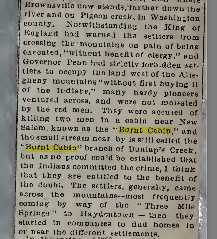
Interestingly the property named in the deed has the moniker Burned Cabin, like the stream that flows through it, an offshoot of Dunlap Creek. The burned cabin was occupied by two men killed by persons unknown, possibly Indians, in the early years of exploration and settlement of the area.
The State of Pennsylvania has early plat maps online showing the early land holdings of its various counties. The Burned Cabin property location can be located on those maps. [7]

Continuing the story of the Matthew Law family, one of his grandsons, Lewis Law Lewton, born on Christmas day 1816, would become a Colonel in the Civil War for Ohio, an Ohio statesman, and a one-time law partner with one of the authors of the 14th Amendment to the U.S. Constitution. Following the nation’s movement westward Lewis eventually settled in Napa Valley California. Today Matthew Law’s descendants live throughout the United States.
How interesting it is to see more clearly some of the fibers in the tapestry of the nation’s history and how things tie together over time.
An Indian Chieftain’s hatchet strike starts a winning war for empire, the grave of a British General, a Revolution, a future First President of a new nation, a circular fort, a burned cabin on a settler’s land, a Civil War, a grandson statesman Colonel, the 14th Amendment, bunting and flags on an ancient road. All of it just a road trip away, in Fayette County Pennsylvania.

[1] U.S. Department of State, Office of the Historian, French and Indian War/Seven Years’ War, 1754–63, https://history.state.gov/milestones/1750-1775/french-indian-war
[2] U.S. Department of State, Office of the Historian, Incidents leading up to the French and Indian War, 1753–54, https://history.state.gov/milestones/1750-1775/incidents
[3] NPS Fort Necessity website, https://www.nps.gov/fone/index.htm
[4] Wikipedia article on National Road. https://en.wikipedia.org/wiki/National_Road
[5] Burned Cabin Deed, image p272, Fayette County PA Deeds, v. A-B 1784-1797, image 403 of 463 on Familysearch.com. https://www.familysearch.org/ark:/61903/3:1:3Q9M-CSFS-69SX-M?i=402&cat=245880
[6] From Pennsylvania Archives book of clippings, unnumbered page. https://cdn.website-editor.net/020d9c979f77483189db333592c7de7f/files/uploaded/Pennsylvania%2520County%2520Histories%252C%2520Scrapbooks%252C%2520Fayette%2520County%252C%2520Volume%252039.pdf
[7]Plat map from a section German Township, Fayette County, PA. http://www.phmc.state.pa.us/bah/dam/rg/di/r17-522WarranteeTwpMaps/r017Map2717FayetteGermanWeb.pdf and Menallen Township, Fayette County PA plat: http://www.phmc.state.pa.us/bah/dam/rg/di/r17-522WarranteeTwpMaps/r017Map2722FayetteMenallenWeb.pdf
Copyright © 2023
