June 2nd to Jun 6th –
We picked up our boat from storage in Northport and got her ready for the trip. She sat in storage over the pandemic of 2020 and so cleaning was more extensive than it was in prior years and took several days. Once cleaned and rigged she was ready to set sail, but we were one crew member short.
June 6th –
We completed provisioning and welcomed our third crewmember John Scott aboard. After he was settled we left for Charlevoix, a trip of about 3.5 hours from Northport Harbor.

June 7th –
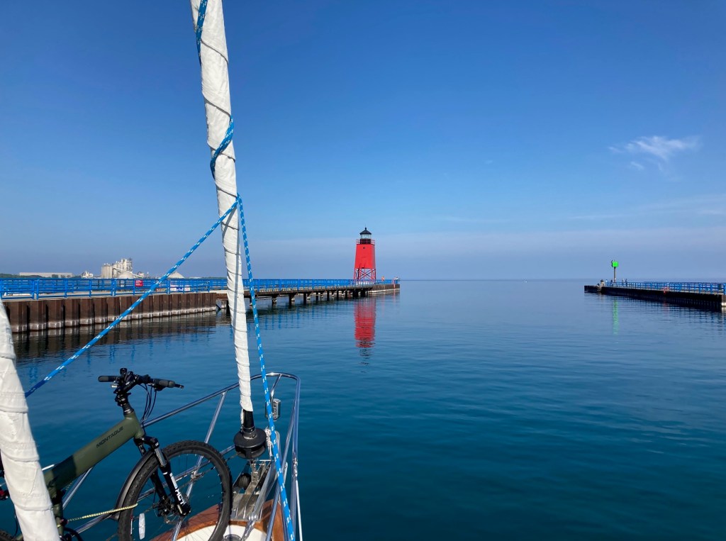
After an evening at Charlevoix’s municipal dock, and in the morning filling up diesel in Charlevoix, we were ready for the trip to Beaver Island.
June 8th –
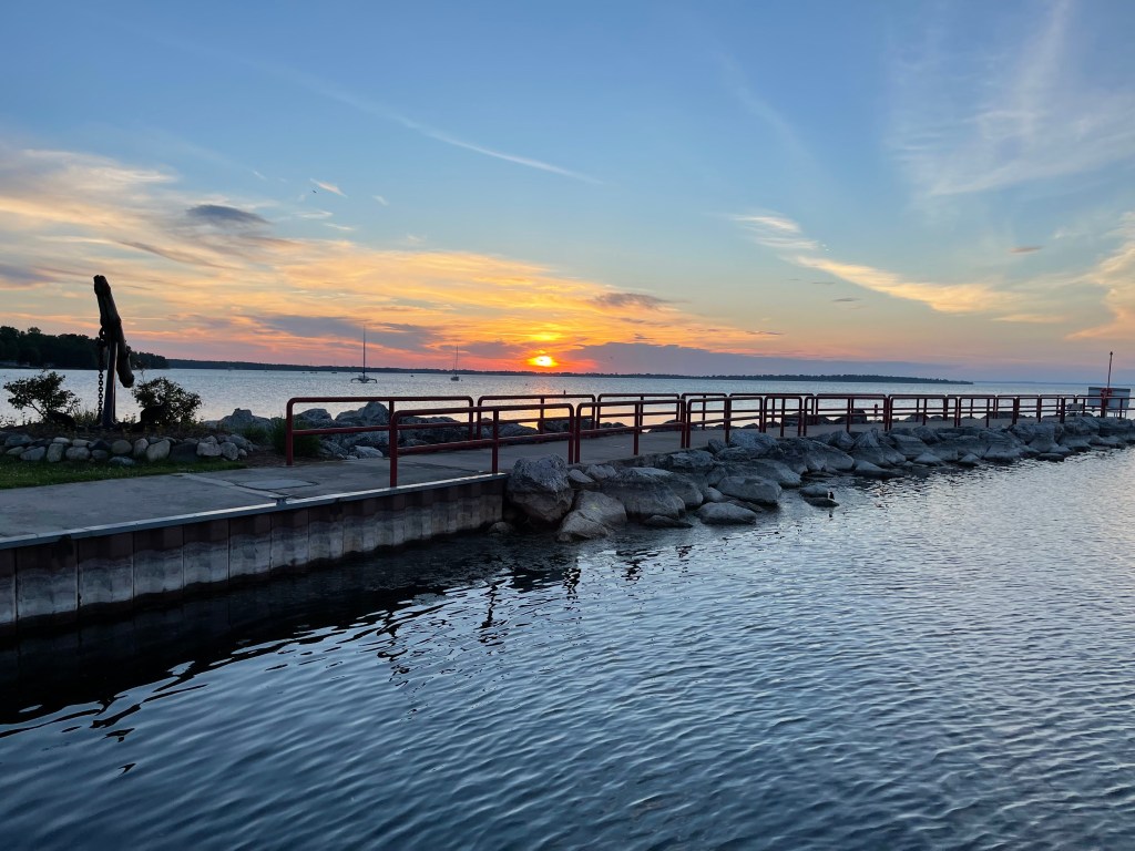
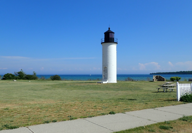
We left dock at 7:30 a.m. 6/8 and arrived at the marina at the north end of the island at about 3:00. Seas were rough for the second half of the trip. Biking around Beaver Island we took in the historical sights of the old town. The island’s totem citizen “Pierre Beaver” was nice enough to place several plaques along the main street that described the history of the Mormon settlement there in the mid-1800’s, as well as the location of the murder of the leader of the community, self-styled King of the Mormons on the island, James Strange. Biking to the other end of the island we admired one of many lighthouses that we would see on our journey.
June 9th –
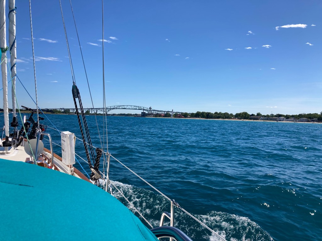
We left Beaver Island at 7:30 for Mackinaw Island. Seas were calm the first half of the trip as we rounded the top of Lake Michigan, traversing the islands and shoals in the Beaver Island vicinity. As we neared the Mackinaw Bridge the seas became bumpier. As we passed under the bridge we noted around eight fast moving ferryboats, moving quickly back and forth between the island and the mainland.
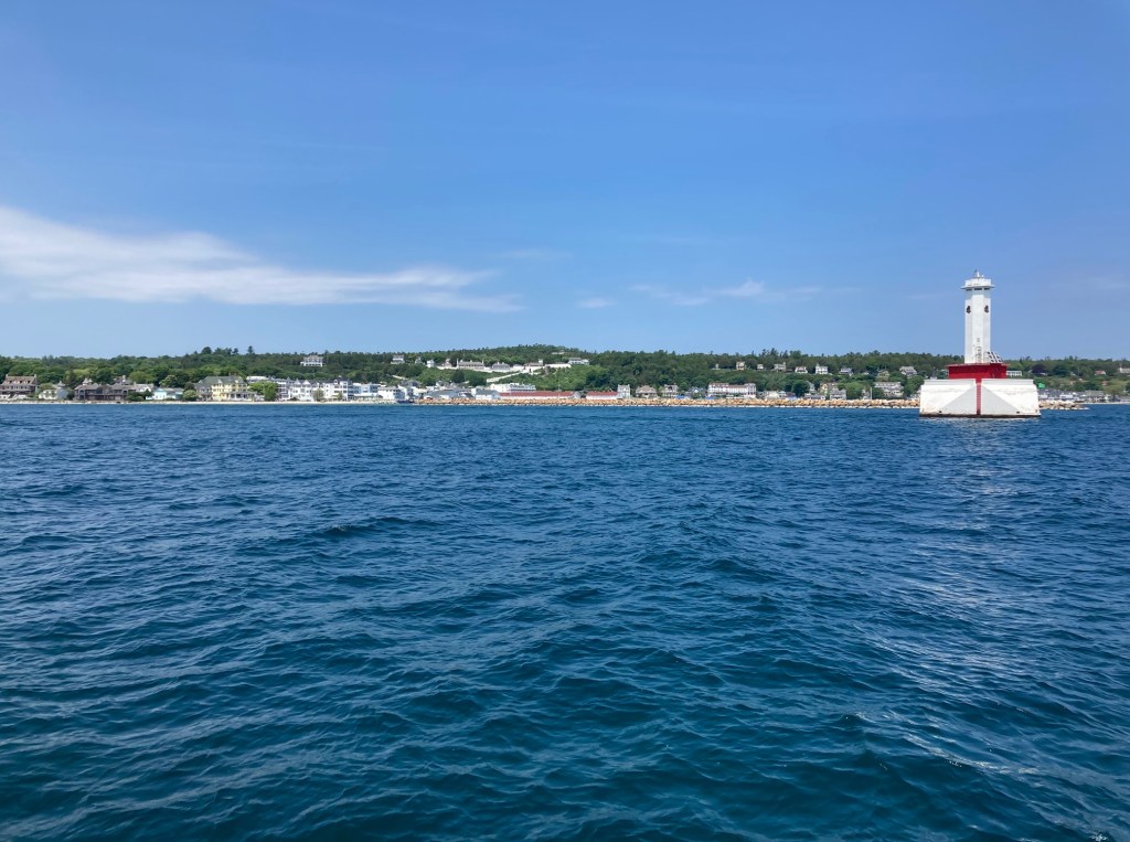
Upon arrival at Mackinaw Island we docked below the ancient fort that is situated high on the hill above the docks. The U.S took over Fort Mackinaw on Mackinaw Island in 1796 but lost it to the British in the War of 1812, only to regain it in 1815 at the war’s end.

We then walked into the street and back into the past. The Island’s fort was established by the British after nearby Fort Michilimackinac was destroyed by Indians. Fort Michilimackinac is on the tip of the mainland of the lower peninsula of Michigan and has been rebuilt. Both forts offer visitors a glimpse back into the early colonial era of Michigan. The Island does not allow cars and it is a time capsule for tourists seeking an immersion into the days of the 1800’s. We made sure to visit one of the fudge shops and purchase some fudge before our departure.

June 10th –
We left Mackinaw Island at 7:30 a.m. for Cheboygan and arrived there at 1:00. Our day two on Lake Huron was greeted with 20-knot winds on our nose, slowing our speed to 4 knots with lots of splashing.
The Covid pandemic is not over yet. Canada was closed to the United States. The genealogy boat trip we that we had planned to Manitoulin Island that was to have taken place last year and that we hoped to make this year needs to be deferred again. Until recently I was unaware of the ancestors in our family that settled on Manitoulin Island and vicinity in the mid-1800’s. There will be a lot to see and research there when the pandemic ends and Canada opens up.
June 11th –
After fueling in Cheboygan we left harbor at 9:30. The NOAA site for weather was no longer working and their new website was not functioning properly. Wind and waves again on our nose slowed progress on the trip to about 4.5 kn. Happy to arrive at Rogers City at 5:00 we ate at a local fish restaurant not far from the dock.
June 12th –
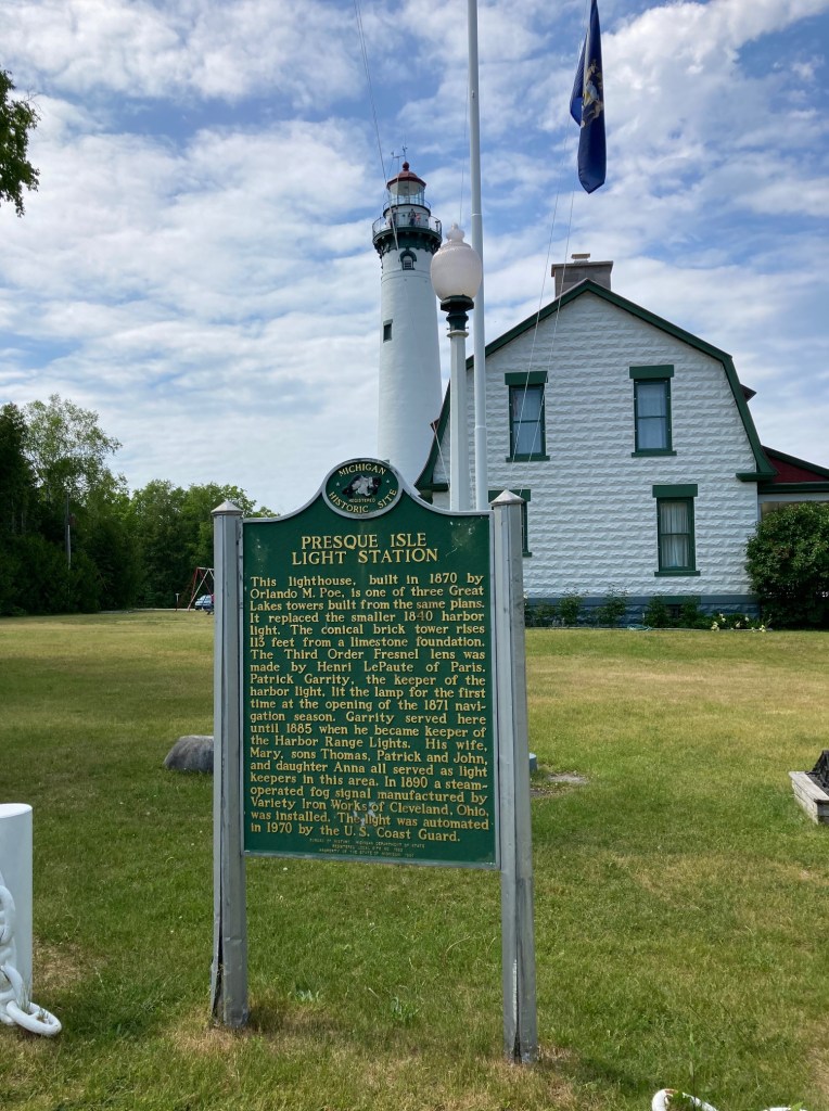
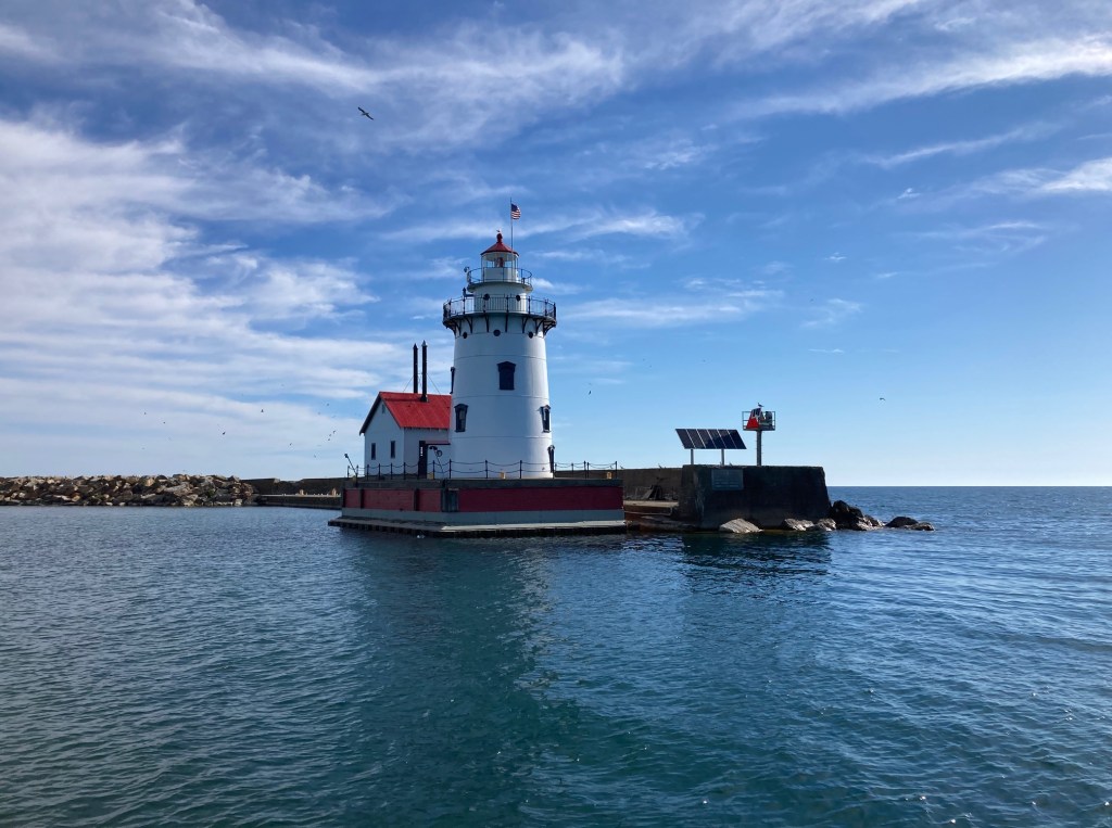
We arrived at Michigan’s Presque Isle State Park after a short 4 hours trip from Rogers City, smooth seas and an 8-knot wind. There are several shipwrecks in the area and placards in the park describe the location of each wreck and their various demises. Lake Huron was not any kinder than Lake Michigan to ships in the 1800’s and many met their doom on its waters.

June 13th –
We exceeded the planned 41 miles to Alpena and went on towards Harrisville, deciding not to spend the time with the extra distance required for travel into Alpena’s harbor.
June 14th –
We completed 60 miles from Harrisville to Harbor Beach. There was an impressive swarm of mayflies requiring the local fire department truck to wash down the Harbor Master’s offices. A large number of seagulls feasted on the insects.

June 15th –
We stayed put at Harbor Beach due to high seas.
June 16th –
We traveled from Harbor Beach to Port Huron. After passing two drawbridges we docked at the city marina. A marina worker, soon to be an MSU junior, along with his UM-student coworker kindly golf carted us to dinner at the local Mexican restaurant and back to our boat.
June 17th –
Today we traveled about 100 miles from Port Huron to River Raisin campground marina. Traveling the last of Lake Huron we said goodbye to that lake and entered the St. Clair River and into the expansive Lake St. Clair, a lovely cruise down both that river and Lake St. Clair.

The St. Clair River alternates between industrial and residential on both of its Canadian and U.S. sides. As it enters Lake St. Clair it becomes very marshy with no sign of human constructions. There was not much traffic on the lake, only a few fishermen in their small boats. The water was clear and peaceful.

Exiting that lake we entered the Detroit River and were on our way to Detroit. We hoped to dock in Detroit but the marinas were either full, or demanded unusual documentation for the boat. The last marina, the State of Michigan’s marina, was deceptively shallow without adequate warning by the employees contacted prior to arrival, so we turned around at its entrance and left.

We abandoned trying to dock in Detroit. We then hoped to drop anchor outside of the city but the area was too industrial and so we continued into the Detroit River. This section of the trip required much awareness of the shallow depths surrounding the main channels of the river. Our draft of about five feet frequently exceeded the depth at the edges of the narrow channel we traveled.

The river, wide but shallow except for the deeper center of the river, changed to a canal well marked for freight traffic, somewhat like a big city highway but on the water. As we traversed the river we were surprised to look back and see that we were being trailed and then passed on starboard side by a large and silent freighter.

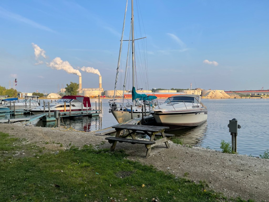
Night fell as we entered Lake Erie and we motored on with the twilight changing to dark. Like several places we passed earlier in the trip on Lake Michigan we saw lighthouses in the lake far out from land marking small islands and shoals. As it got completely dark we fortunately arranged for a slip at River Raisin in Monroe Michigan.
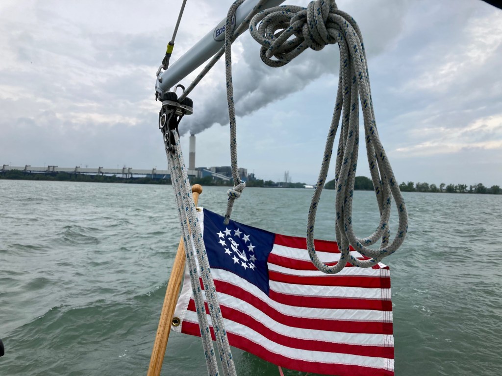
Requiring an approach in the dark through a narrow channel cutting through shallows we located the entry with the help of our chartplotter. Guiding the boat between the lighted red and green channel markers we aimed at the flashing white light far off between the colored lights. Finally we entered a small harbor that is nestled next to a large DTE power plant. Huge swarms of mayflies surrounded the light of the street lamps in the powerplant area. After some searching in yet more shallow water we located an empty slip with the aid of our spotlight and docked at the short slip for the night.
River Raisin campground is near the River Raisin War of 1812 battle site. That battle took place in 1813 and was a catastrophe for the U.S. The battle was a massacre of several hundred Americans by the British and their Indian allies that gave rise to the battle cry “Remember the Raisin”.
There is a National Park Service center across the Dixie Highway from the battlefield as well as a walking path through the battlefield. Today there are many eagles and swans in the area of River Raisin’s harbor, and in the nearby wildlife area.
June 18th –
We stayed docked at River Raisin due to bad weather.
June 19th –
We made our way to Huron Ohio. En route far from shore we avoided collision with a fishing powerboat. The powerboat was speeding along with no one minding the wheel and we quickly changed course to avert collision. As it sped by I could see the occupants with their noses in their devices, oblivious then uncaring about the narrow miss. At Huron Ohio the slip where we docked was along the river at a shipyard marina. The marina is part of a boat repair facility and is partly rundown as part of its walkway is sagging and collapsing near to the water line, presumably awaiting end of Covid-epidemic repairs.

June 20th –
On to Cleveland. On the way a storm of blackflies moved into the cockpit keeping things lively. Then, right in front of Cleveland, we were hit by a storm of a different sort, a sudden squall with zero visibility fog and blinding rain. We turned on the radar and circled slowly several hundred yards in front of the downtown breakwater, as did several other boats. The storm lifted in 10 minutes and we made our way to the city municipal marina.
June 21st –
Six to seven-foot waves so we stayed put for the day.
June 22nd –
We docked at Racine State Park after a bumpy ride of eight hours. Dockhands insisted on moving the boat backwards along the dock wall in a gusty wind, marring our bright-work in the process, to make room for a 60 foot boat scheduled to arrive later. That boat canceled its arrival. The marina is a short walk to a nearby hotel with a lovely outside dining area and full menu which we happily indulged in.

June 23rd –

We passed Perry’s Monument, Misery Bay, Erie State Park and arrived at the marina after a day of travel on smooth water under blue skies. Perry’s Landing takes its name from Commodore Perry whose ships decisively defeated the British navy in a battle fought on Lake Erie, speeding an end to the War of 1812. Erie Pennsylvania was the birthplace and harbor of much of the Great Lakes American Fleet in that war.

Monument to Commodore Perry at Erie State Park – Misery Bay is in background
